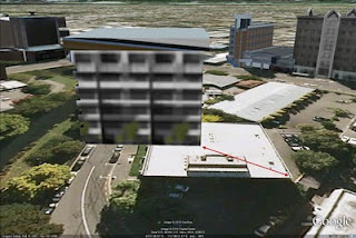
A common challenge for geo-modelers are imagery updates that occur after a building model has been published to Google Earth. In some updates models were unaffected, but in others, models became misaligned (some significantly).

We appreciate the fact that our enthusiastic geo-modeling community prefers to spend their time creating buildings instead of chasing imagery around. Our engineers have been hard at work solving this problem.
Very shortly we'll be running a program that identifies models that have been affected by imagery shifts, and automatically adjust them. The earth is an imperfect place so it’s possible, that not every building will adjust perfectly. However, our testing suggests that this new system of tracking imagery updates should help immensely. This new feature will work both retroactively and into the future. You can be rest assured that we’ll be trying to keep your models aligned properly going forward as our imagery is updated.
If your model was affected by this process you'll see a notification on your model details page. The notification will indicate whether we were able to automatically adjust the model or not.


In either case, we encourage you to review your models in the Google 3D Warehouse to see whether any action is required by you. We apologize for the inconvenience that this issue has caused and hope that this system improvement will be met with much user-happiness.


0 comments
Post a Comment